From Periodic Surveys to Persistent Seabed Awareness
5 ways autonomous systems and connected data are changing offshore energy
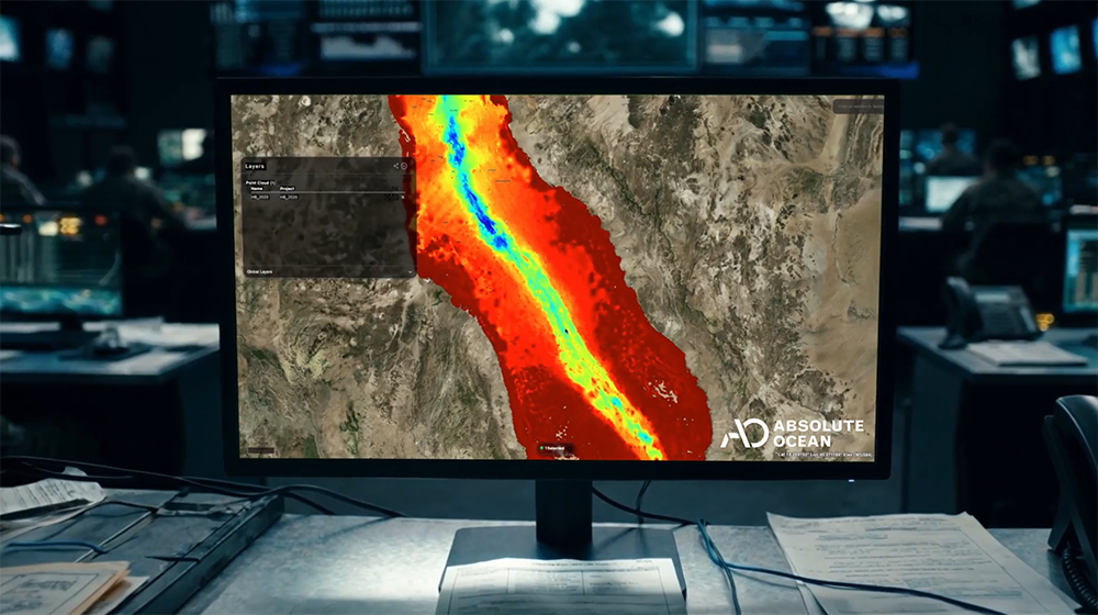
Offshore energy depends on what happens below the surface.
Pipelines, cables, platforms, export infrastructure, subsea assets, environmental habitats, and construction sites all operate in dynamic marine environments. Conditions change. Assets age. Weather, traffic, sediment movement, turbidity, and human activity create operational risk.
For decades, offshore operators have managed that complexity through periodic surveys, inspections, and reports. Those workflows remain essential, but the operating environment has changed.
Offshore infrastructure is expanding. Asset bases are aging. Inspection demands are increasing. Environmental requirements are growing. Operators need faster access to trusted seabed information and better ways to share that information across engineering, operations, environmental, commercial, and leadership teams.
Autonomous systems are changing how offshore data is collected. Connected data platforms are changing how that data is used.
The larger shift is from project-based survey deliverables to persistent seabed awareness.
Terradepth’s Ocean Operating System™ helps offshore operators make that shift through autonomous collection capabilities and Absolute Ocean®, a cloud-based platform that connects ocean data in a shared geospatial environment. Together, these capabilities help teams collect, visualize, compare, share, and operationalize critical subsea information.
Here are five ways autonomous systems and connected data are transforming offshore energy operations.
1. Safer Pipeline and Subsea Infrastructure Monitoring
Subsea pipelines, power cables, and offshore infrastructure operate in environments that can change quickly.
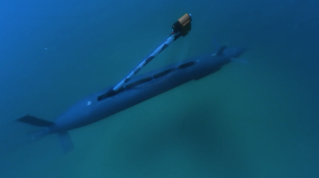
Inspection work can become difficult in areas with heavy vessel traffic, high turbidity, poor visibility, deep water, or navigational constraints. In these environments, autonomous underwater vehicles can provide a safer and more efficient way to collect high-quality data around critical assets.
In one recent project, a pipeline inspection was required in an area with dense commercial ship traffic. ROV inspection methods faced operational challenges due to surface activity and poor visibility. By deploying an autonomous underwater vehicle beneath the traffic, the inspection team completed the mission safely and identified the area of concern without disrupting vessel movement.
The data supported an operational decision.
When inspection data moves quickly into a connected environment, teams can review conditions, compare findings, and coordinate next steps with greater confidence.
As offshore infrastructure expands and ages, autonomous systems will play a growing role in asset monitoring. The operators that gain the most value will be the ones that can turn those missions into usable operational knowledge at relevant speed.
2. Faster Offshore Construction and Site Characterization
Offshore construction depends on accurate seabed information.
Energy facilities, export infrastructure, cable routes, coastal developments, and subsea installations all require a clear understanding of bathymetry, geology, hazards, and site conditions. Better data reduces uncertainty in planning, design, engineering, permitting, and execution.
In one project supporting a proposed desalination facility, steep underwater cliffs and deep-water conditions created survey challenges. Conventional approaches would have increased cost and complexity.
Autonomous systems enabled high-resolution seabed data collection with approximately six-centimeter accuracy in difficult-to-access areas. The data was delivered through a cloud-based environment where stakeholders could review, visualize, and interpret results within hours, without waiting for traditional reporting cycles.
That matters because offshore construction decisions are often constrained by time.
When teams can access trusted seabed information earlier, they can reduce uncertainty, compress planning cycles, and improve confidence in engineering decisions. A connected data environment also gives multiple stakeholders access to the same operational picture, which reduces friction between field teams, technical teams, and decision-makers.
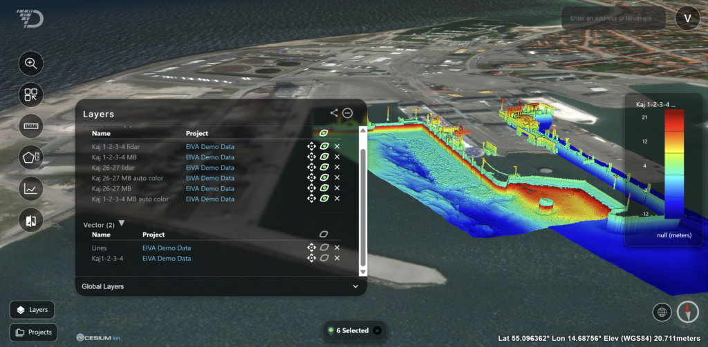
Multilayer Data of Port in Absolute Ocean
3. Combined Engineering and Environmental Assessment
Offshore projects increasingly require operators to meet engineering goals and environmental obligations at the same time.
A cable inspection may also require habitat assessment. A construction project may require geophysical data and environmental monitoring. A route survey may need to support design, permitting, and stewardship requirements across several teams.
Historically, those needs often produced separate campaigns, separate datasets, and separate reporting workflows. That adds cost, mobilization time, and operational complexity.
Autonomous systems can collect multiple datasets during a single operation. Connected platforms can bring those datasets into one environment quickly enough to support responsive survey operations.
For one high-voltage direct current cable inspection project, operators needed to assess subsea infrastructure and nearby seagrass habitats. Autonomous systems supported the collection of multiple data types in one workflow while minimizing disturbance to the surrounding ecosystem.
Once collected, the data was integrated into a secure geospatial platform where stakeholders could visualize conditions, share findings, and make informed decisions from a common operating picture.
This combined workflow is becoming increasingly valuable across offshore energy. It allows operators to get more focused value from each mission while supporting engineering, environmental, and regulatory needs.
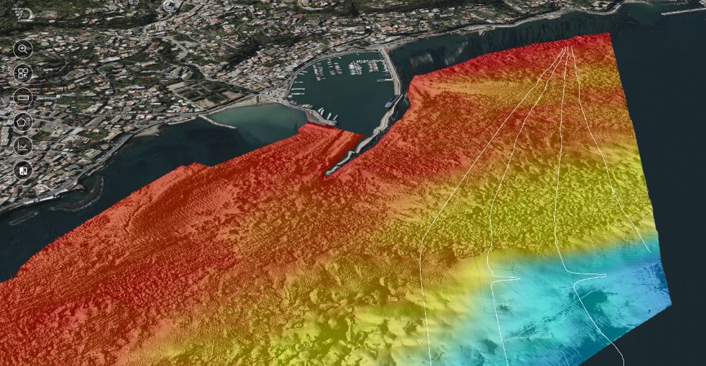
4. Faster Response to Operational Anomalies
When anomalies are detected, speed matters.
Whether responding to unexpected seabed changes, potential infrastructure concerns, severe weather events, or operational incidents, organizations need rapid access to trusted information.
Autonomous systems can often be mobilized more quickly and operate with fewer logistical requirements than traditional approaches. Combined with cloud-based data delivery and collaboration tools, operators can move from investigation to actionable insight in days rather than weeks.
Instead of waiting for information to be processed, packaged, and distributed, project teams can begin evaluating conditions and coordinating responses almost immediately.
As offshore operations become increasingly data-driven, reducing the time between collection and decision-making will continue to provide a competitive advantage.
5. Turning Data Collection into Persistent Operational Awareness
Most offshore operators already have significant ocean data.
They have survey data, inspection records, environmental assessments, bathymetry, imagery, engineering files, and historical reports. Much of that information is valuable. Too much of it is difficult to access, compare, or operationalize across teams.
This is where connected data environments change the operating model.
Modern ocean data platforms allow stakeholders to bring information from multiple sources into a shared geospatial environment. Historical surveys, infrastructure inspections, environmental observations, and operational datasets can be combined to support better decisions over time.
The result is a persistent record of seabed conditions and asset knowledge.
That record becomes more valuable with every mission. A new survey can be compared against previous conditions. An inspection can become part of an asset history. Environmental data can be reviewed alongside infrastructure data. Teams can move from one-off deliverables to continuous awareness and statistical insight.
This shift may be the most important impact of autonomous systems on offshore energy.
Autonomous vehicles collect the data. Connected platforms turn that data into operational knowledge.
The future of offshore energy is connected
The future of offshore energy will be shaped by the operators that can understand, manage, and protect subsea assets with speed and confidence.
Autonomous systems will expand what can be collected. Connected data platforms will determine how much of that information becomes useful, and how quickly it becomes actionable.
The organizations that can rapidly collect, connect, and act on seabed data will be better positioned to reduce risk, improve efficiency, respond to change, and support long-term operational resilience.
Terradepth helps offshore operators make that transition.
Through autonomous collection, Absolute Ocean®, and the Ocean Operating System™, Terradepth helps teams move from periodic surveys to persistent seabed awareness.
Ready to move from periodic surveys to persistent seabed awareness?
See how Absolute Ocean brings survey, inspection, environmental, and asset data into one connected operating environment. Request a Demo.