
Ocean Data at Your Fingertips
Absolute Ocean (AO) is Terradepth’s easy-to-use, cloud-native, geospatial data management solution, providing ocean data visualization, analysis and collaboration to internal and external stakeholders. AO can be leveraged to concurrently manage existing customer-owned data sets while accessing data provided by Terradepth or other third parties.
Better and Faster Ocean Decisions
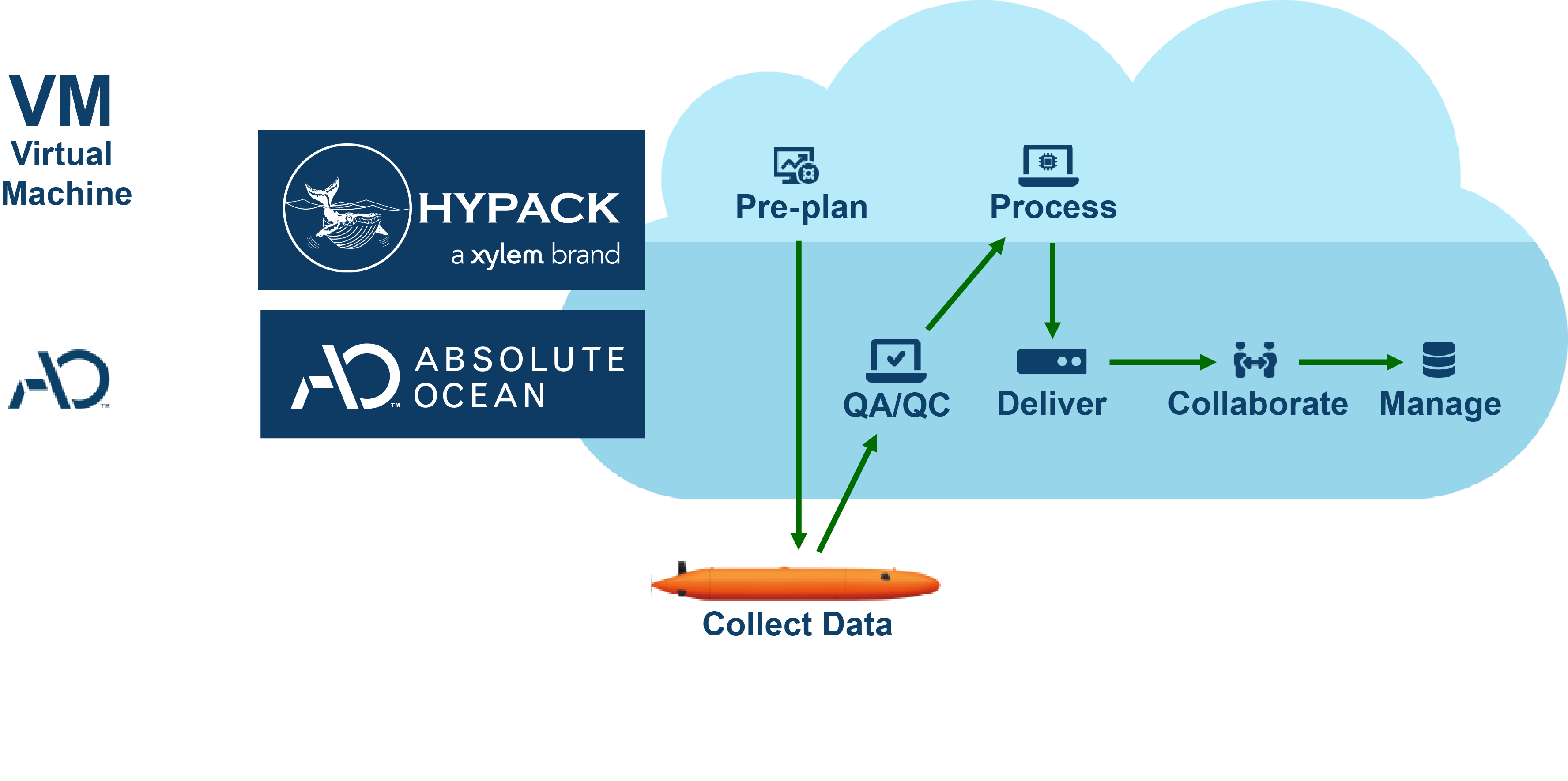
Integrating HYPACK’s processing software with the Absolute Ocean (AO) platform optimized ocean survey workflows, boosting speed, collaboration, and cutting costs. HYPACK’s tools, embedded within AO’s cloud environment, enabled a seamless data pipeline with real-time access. Survey teams can now process and analyze data directly in the cloud.

Integrating HYPACK’s processing software with the Absolute Ocean (AO) platform optimized ocean survey workflows, boosting speed, collaboration, and cutting costs. HYPACK’s tools, embedded within AO’s cloud environment, enabled a seamless data pipeline with real-time access. Survey teams can now process and analyze data directly in the cloud.
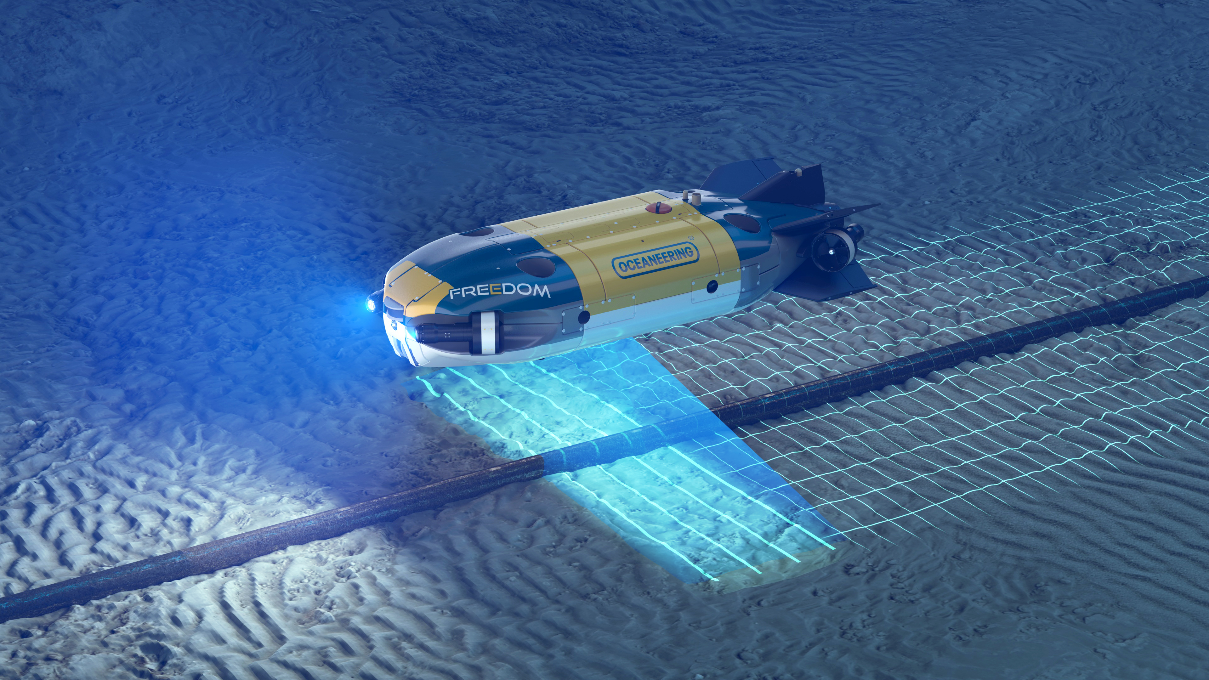
Terradepth’s Absolute Ocean enabled Oceaneering to deliver high-resolution subsea data to the customer using an easy-to-use Google Earth-like tool the same day as collection, drastically reducing turnaround times and enhancing decision-making.

Terradepth’s Absolute Ocean enabled Oceaneering to deliver high-resolution subsea data to the customer using an easy-to-use Google Earth-like tool the same day as collection, drastically reducing turnaround times and enhancing decision-making.
By integrating Absolute Ocean into their operations, Seaprod streamlined workflows and achieved measurable improvements. The platform’s near real-time data upload capabilities allowed surveyors to validate area coverage while teams were still in the field, reducing survey time by 15% and enabling Seaprod to take on more projects with the same staff, increasing revenue by 20%.

By integrating Absolute Ocean into their operations, Seaprod streamlined workflows and achieved measurable improvements. The platform’s near real-time data upload capabilities allowed surveyors to validate area coverage while teams were still in the field, reducing survey time by 15% and enabling Seaprod to take on more projects with the same staff, increasing revenue by 20%.

The implementation of Absolute Ocean has yielded remarkable results for IIC Technologies, resulting in reduced timelines for delivering final products to clients. The most notable achievement is the drastic reduction in data transfer time resulting in a four-fold increase in network throughput which is caused by AO’s upload and download tool connecting to AO’s high-performance and secure Google Cloud infrastructure through an application programming interface (API).

The implementation of Absolute Ocean has yielded remarkable results for IIC Technologies, resulting in reduced timelines for delivering final products to clients. The most notable achievement is the drastic reduction in data transfer time resulting in a four-fold increase in network throughput which is caused by AO’s upload and download tool connecting to AO’s high-performance and secure Google Cloud infrastructure through an application programming interface (API).

Increasing operational efficiency for S.T. Hudson Engineers, Inc.
With AO, S.T. Hudson easily uploaded and visualized data sets sourced from a variety of sensor technologies across multiple common industry file formats to provide its customer with a status preview of the data.

Increasing operational efficiency for S.T. Hudson Engineers, Inc.
With AO, S.T. Hudson easily uploaded and visualized data sets sourced from a variety of sensor technologies across multiple common industry file formats to provide its customer with a status preview of the data.

25% INCREASE IN OPERATIONAL EFFICIENCY. $100K SAVED IN IT COSTS.
Absolute Ocean changed the game for survey company AROBOTNX when they were able to coin the phrase "Daily Survey Progress Report" (DSPR) for their clients.

25% INCREASE IN OPERATIONAL EFFICIENCY. $100K SAVED IN IT COSTS.
Absolute Ocean changed the game for survey company AROBOTNX when they were able to coin the phrase "Daily Survey Progress Report" (DSPR) for their clients.

COLLABORATE EFFICIENTLY
Easily communicate with all stakeholders inside and outside the organization, without a GIS expert or complex tool. Seamlessly share precise views of any survey data in AO with a colleague.

ANALYZE DATA
Determine elevation, measure distances and areas, and view the profile line of terrain with easy-to-use tools. Efficiently compare old and new survey results with historical and current data sets in the same solution.

ACCESS AND MANAGE DATA
User-uploaded data can be shared broadly with the AO community, or access can be limited through permissions management. AO can store many versions of data, as well as visualized or non-visualized files and raw data.

LEVERAGE OCEAN KNOWLEDGE
Interact with 2D and 3D ocean data sets from around the world and narrow results by location and time period. Metadata associated with each data source is cataloged and contributes to the robust search features within AO.
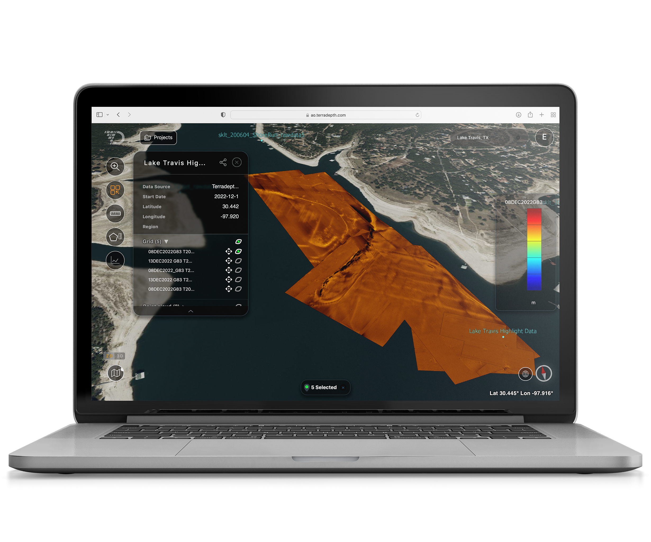
Ocean Data Supported for Better Operational Efficiency
Visualization of data types currently supported by AO include:

Ocean Data Supported for Better Operational Efficiency
Visualization of data types currently supported by AO include:
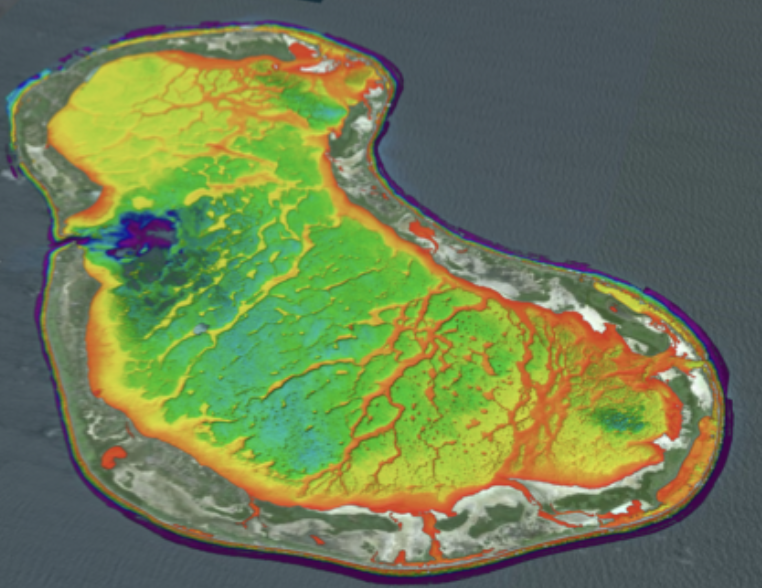
BATHYMETRY
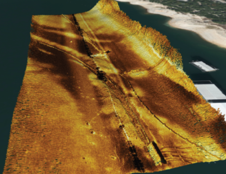
SIDE SCAN SONAR
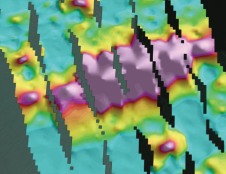
MAGNETOMETER

SUB-BOTTOM PROFILING
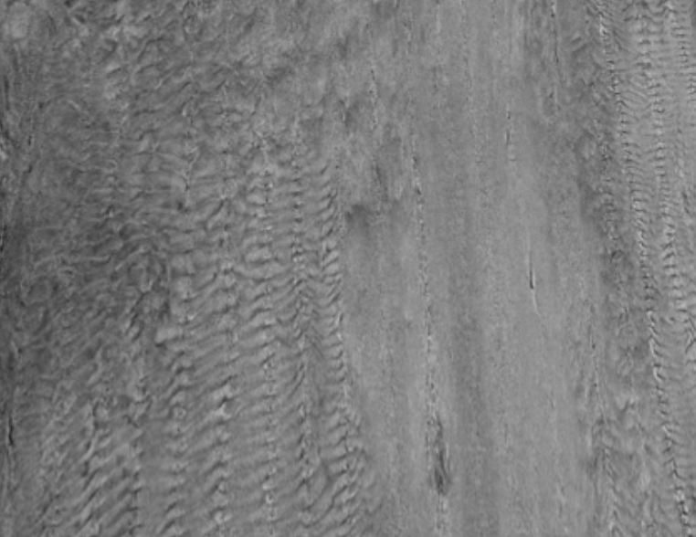
BACKSCATTER

SAS

OPTICAL

LIDAR
Help Center
AO provides flexible learning options, including video tutorials, FAQs, knowledge base articles, guides and product release notes.