Case Study
Terradepth and T&T Survey Saved Gulf Copper and the Battleship Texas Foundation a Full Day of Downtime for their ~60 Person Team, by Surveying Underneath Battleship Texas
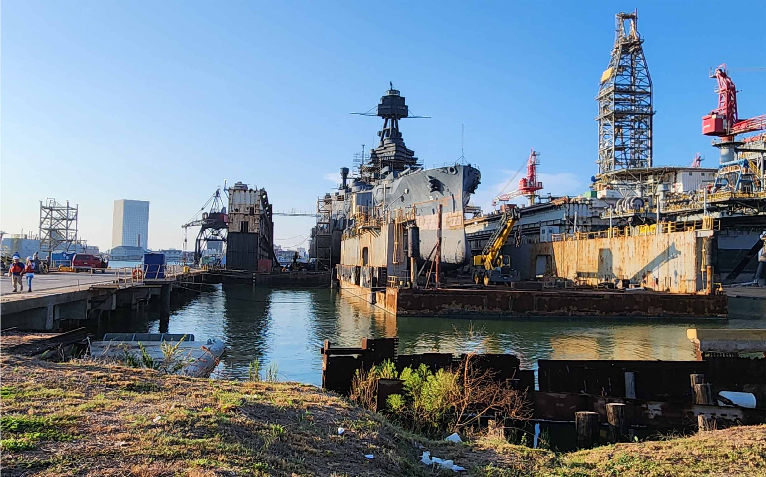
Case Study
Terradepth and T&T Survey Saved Gulf Copper and the Battleship Texas Foundation a Full Day of Downtime for their ~60 Person Team, by Surveying Underneath Battleship Texas
Case Study
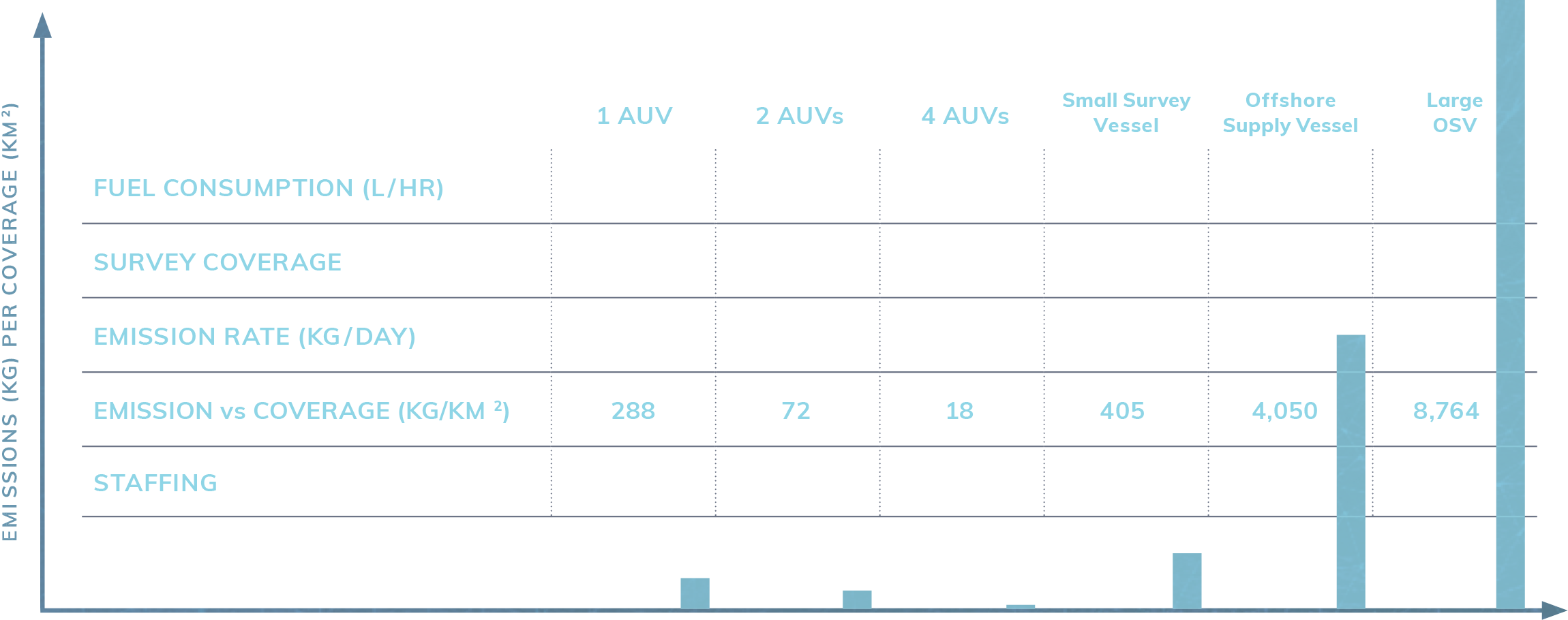
Autonomous Underwater Vehicle (AUV) Survey Services: Safer and Faster Operations (55% more efficient) in Challenging Conditions Compared to Traditional Surveys

Case Study
Autonomous Underwater Vehicle (AUV) Survey Services: Safer and Faster Operations (55% more efficient) in Challenging Conditions Compared to Traditional Surveys
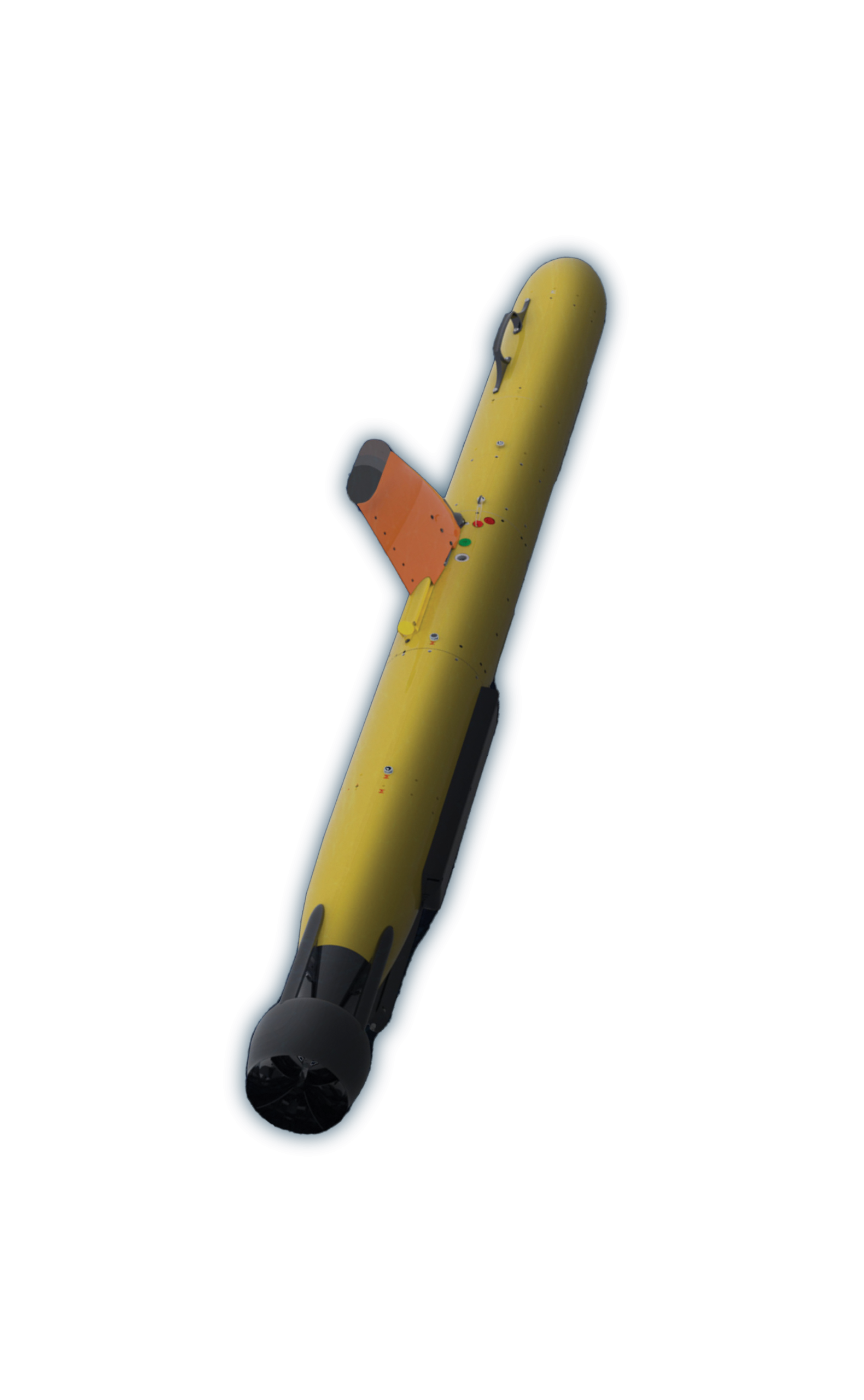
Autonomous Survey Platforms
- AUV Model: Teledyne Gavia
- Depth: 1,000 Meters
- Battery: 2 x 1.6kW LI, For Operations Up to 18 Hours
- Navigation: iXblue Phins C5, Teledyne Pathfinder DVL/ADCP, Sonardyne AvTrack 6 USBL
- Side Scan: EdgeTech 2205 600/1600kHz
- MBES: Teledyne Reson T20
- Sub-bottom: Teledyne Benthos SBP, 14kHz-21kHz
- Mag: OFG Self-Compensating Magnetometer
- Camera: Camera Sony ICX285 CCD
Commercial Applications
- Site Clearance and Verification Surveys
- Pre-lay and Post-lay Construction Surveys
- Pipeline and Submerged Cable Inspection Surveys
- Structural and Asset Inspection
- Dredging and Trenching Support
- Magnetic Anomalies and Unexploded Munitions Detection
- Benthic Habitat Surveys
- Archaeological Surveys
- Mineral Surveys
- Search and Recovery
- Hazard Surveys
- Optical Documentation